Sports» Trekking» Maps» Maps of Finland» Nautical Charts and Boating Maps» Sea maps»
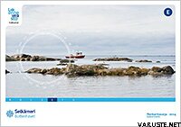
Chart Folio E, Sea of Bothnia 2014
Availability
This product is not for sale at the moment.
Detailed availability
Reviews
Product description
Weight
1,002 kg
Isbn
978-952-266-150-0
CommentsAdd a comment
This product is not for sale at the moment.
Detailed availability
Reviews
| Overall rating | (1 review) |
Product description
Liikenneviraston julkaisemat Merikarttasarjat soveltuvat mittakaavansa ja tarkkuutensa puolesta saaristo- ja rannikkonavigointiin. Merikarttasarja kertoo muun muassa väylien ja viittojen sijainnit, vedenalaiset karit ja johdot sekä syvyystiedot. Merikarttasarja on kierresidottu karttalehtiö, joka on pakattu muovitaskuun.
Merikarttasarjojen karttalehtiä on täydennetty yksityiskohtaisilla erikoiskartoilla, jotta veneily olisi turvallista satamien ja kapeikkojen läheisyydessä. Karttasarjojen mittakaava on 1:50 000 (1 cm kartalla = 500 m). Karttojen koordinaattijärjestelmä on EUREF-FIN (WGS 84).
The approximate size of the packed product or the sales package is 448 x 523 x 10 mm.
Weight
1,002 kg
Isbn
978-952-266-150-0
CommentsAdd a comment

