All-terrain GPS Navigator
- Internal antenna with GPS and GLONASS satellite reception for tracking in more challenging environments than GPS alone; for better reception in -vehicle interiors add an external antenna (sold separately) to the built-in MCX connector
- Built-in worldwide basemap and free 1-year BirdsEye Satellite Imagery subscription
- Supports Garmin TOPO maps, Garmin HuntView™ maps, BlueChart® g2 HD marine charts and more
- Supports Active Weather forecasts and animated weather tracking
- Pairs with your compatible smartphone¹ for automatic uploads, smart notifications and more
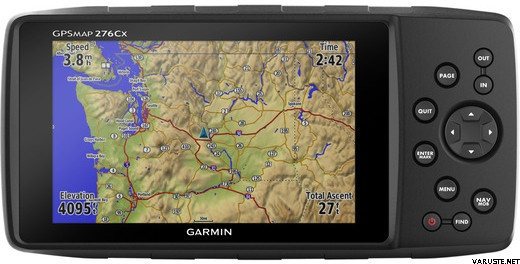
If you’re a jack-of-all-trades, you need a GPS navigator that’s as versatile as you are. Take a look at the GPSMAP 276Cx. With a large 5-inch display, versatile cartography, connected features and flexible power options, it has the capability to function the best way for you.
IN THE BOX
- GPSMAP 276Cx
- 1 year BirdsEye Satellite Imagery subscription¹
- AMPS powered mounting bracket with marine bail mount
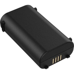
- Lithium-ion rechargeable battery pack
- USB cable
- AC charger
- Quickstart Guide
¹Software download required. Use the included BirdsEye Satellite Imagery subscription with BaseCamp™ to transfer an unlimited amount of high-resolution satellite images to the handheld device for 1-year. Once those images have been integrated into the device they can be accessed whenever you need them — even after the initial 1-year offer has run out. Additional BirdsEye Satellite Imagery subscriptions can be purchased.
The Mapping You Want
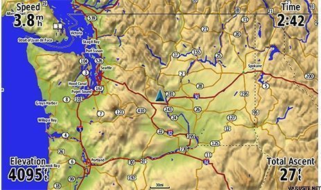
Almost anywhere you want to go, GPSMAP 276Cx has a compatible map to take you there. It comes preloaded with worldwide basemap and includes a free 1-year BirdsEye Satellite Imagery subscription. It also supports a variety of other mapping options such as Garmin TOPO maps, Garmin HuntView™ maps,BlueChart® g2 HD marine charts, turn-by-turn directions on City Navigator® NT, Garmin Custom Maps, raster maps and vector maps.
The Connected Navigator
In addition to GPS and GLONASS reception, GPSMAP 276Cx is ANT+® compatible for the integration of external sensors like the tempe™ ambient temperature sensor. You can even connect it to Wi-Fi® for over-the-air updates and Garmin Connect™ database syncs. Pair with your compatible mobile device¹ for additional features like LiveTrack and smart notifications¹.
Tough and Ready
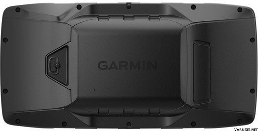
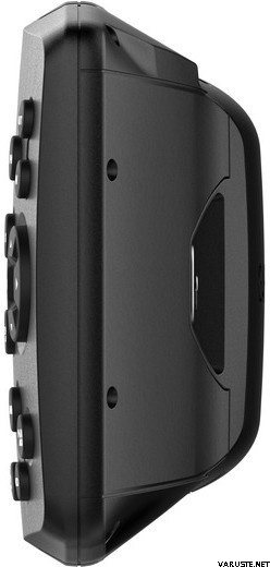
GPSMAP 276Cx was designed for your rugged lifestyle. You’ll navigate with confidence by seeing clearly on the large 5-inch sunlight-readable screen. The navigator’s flexible mounting lets you keep the device exactly where you need it. Operate GPSMAP 276Cx with its reliable push-button controls that resist dirt, dust and grit, and best of all –– keep all your maps on hand with 8 GB of internal memory, expandable by a microSD™ card (sold separately).
More Power Options
Get peace of mind knowing that the GPSMAP 276Cx GPS navigator is going to be ready when you need it, now that there are more ways to power your device. It features in-unit charging with an included lithium-ion battery pack and even has the ability to use standard AA batteries.
¹See Garmin.com/ble
Weather is not available in all areas.
Wi-Fi® is a registered trademark of the Wi-Fi Alliance.
Physical & Performance
|
|
Physical dimensions
|
7.5" x 3.7" x 1.7" (191.5 x 94.5 x 44.0 cm)
|
|
Display size, WxH
|
5.0" (127.0 mm) diagonal
|
|
Display resolution, WxH
|
800 x 480 pixels
|
|
Display type
|
bright, sunlight readable WVGA display
|
|
Weight
|
15.9 oz (450 g) with included rechargeable pack; 14.6 oz (415 g) with AA batteries (not included)
|
|
Battery
|
rechargeable lithium-ion (included) or 3 AA batteries (not included); NiMH or Lithium recommended
|
|
Battery life
|
up to 16 hours (lithium-ion); up to 8 hours (AA batteries)
|
|
Water rating
|
IPX7
|
|
High-sensitivity receiver
|
|
|
Interface
|
high-speed USB and NMEA 0183 compatible
|
|
Camera
|
no
|
|
Barometric altimeter
|
|
|
Electronic compass
|
Yes (tilt-compensated 3-axis)
|
|
Unit-to-unit transfer (shares data wirelessly with similar units)
|
|
Maps & Memory
|
|
Basemap
|
|
|
Ability to add maps
|
|
|
Built-in memory
|
8 GB (6 GB available to use)
|
|
Accepts data cards
|
microSD™ card (not included)
|
|
Custom POIs (ability to add additional points of interest)
|
|
|
Waypoints/favorites/locations
|
10,000
|
|
Routes
|
250
|
|
Track log
|
20,000 points, 250 saved tracks
|
Outdoor Features
|
|
Automatic routing (turn by turn routing on roads)
|
Yes (with optional mapping for detailed roads)
|
|
Custom maps compatible
|
|
|
Hunt/fish calendar
|
|
|
Sun and moon information
|
|
|
Tide tables
|
Yes (with optional Bluechart)
|
Garmin Connect™
|
|
Garmin Connect™ compatible (online community where you analyze, categorize and share data)
|
|
Additional
|
|
Additional
|
- Map segments: 15,000
- Wi-Fi: yes
- ANT+: yes
- Bluetooth: yes
- Active weather: yes
|


 台湾
台湾 — オリジナルを見る