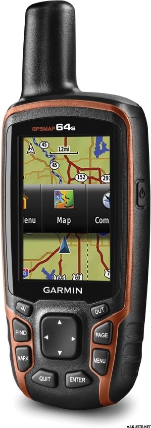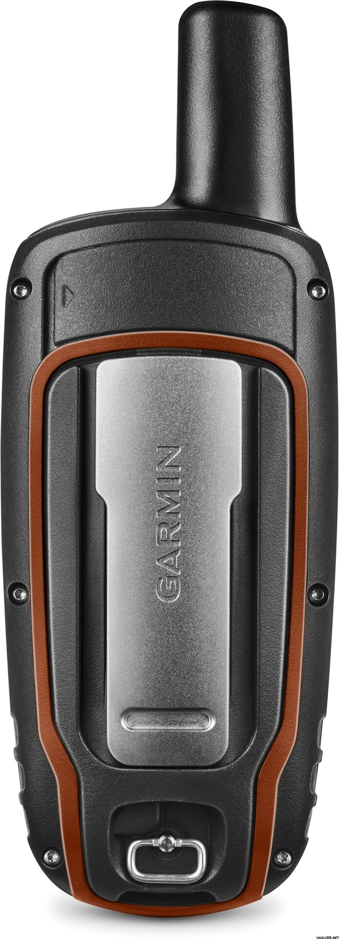
Garmin GPSMAP 64s
Tento produkt momentálne nie je v predaji.
Skladová dostupnosť
Hodnotenia
| Celkové hodnotenie | (70 hodnotenia/hodnotení) |
Popis produktu
Rugged, Full-featured Handheld with GPS, GLONASS and Wireless Connectivity
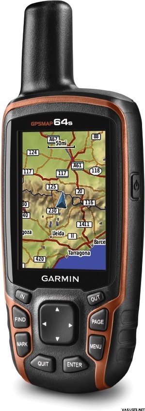
2.6" sunlight-readable color screen
High-sensitivity GPS and GLONASS receiver with quad helix antenna
1-year BirdsEye Satellite Imagery subscription
3-axis compass with barometric altimeter
Wireless connectivity via Bluetooth® technology¹ or ANT+™
GPSMAP 64s
GPSMAP 64s features a 2.6” sunlight-readable color screen and a high-sensitivity GPS and GLONASS receiver with a quad helix antenna for superior reception. GPSMAP 64s includes a 3-axis electronic compass with barometric altimeter, wireless connectivity and a 1-year BirdsEye Satellite Imagery subscription.
Get Your Bearings
GPSMAP 64s has a built-in 3-axis tilt-compensated electronic compass, which shows your heading even when you’re standing still, without holding it level. Its barometric altimeter tracks changes in pressure to pinpoint your precise altitude, and you can even use it to plot barometric pressure over time, which can help you keep an eye on changing weather conditions.
Share Wirelessly
Share your waypoints, tracks, routes and geocaches wirelessly with other compatible devices. Your friends can enjoy your favorite hike or cache without waiting for you to plug in to your computer — simply press “send” to transfer your information to another Garmin handheld.
GPSMAP 64st also connects to compatible Garmin devices, including VIRB™ and accessory sensors, including tempe™, foot pod and heart rate monitor.
Stay Connected
With Smart Notification you can wirelessly receive email, texts and alerts from your compatible iPhone® 4s or later. Stay connected without having to dig into your backpack for your smartphone.
Explore the Terrain
GPSMAP 64s comes with a built-in worldwide basemap with shaded relief plus a 1-year BirdsEye Satellite Imagery subscription, so you can navigate anywhere with ease. With photo navigation, you can download geotagged pictures from the Internet and navigate to them.
Keep Your Fix
With its quad helix antenna and high-sensitivity, GPS and GLONASS, receiver, GPSMAP 64s locates your position quickly and precisely and maintains its location even in heavy cover and deep canyons. The advantage is clear — whether you’re in deep woods or just near tall buildings and trees, you can count on GPSMAP 64s to help you find your way when you need it the most.
Add Maps
GPSMAP 64s comes with a built-in worldwide basemap with shaded relief and a 1-year subscription of BirdsEye Satellite Imagery for a photo-realistic view. Adding more maps is easy with our array of detailed topographic, marine and road maps. With 4 GB of onboard memory and microSD™ card slot, you can conveniently download TOPO 24K and 100K maps and hit the trail, plug in BlueChart® g2 preloaded cards for a great day on the water or City Navigator NT® map data for turn-by-turn routing on roads (see maps tab for compatibility). In addition, the 64s is compatible with Garmin Custom Maps, a map format that allows you to transform paper and electronic maps easily into downloadable maps for your device, for free.
Find Fun
GPSMAP 64s supports paperless geocaching with 250,000 preloaded caches with hints and descriptions from Geocaching.com, and has a 16-hour battery life. By going paperless, you're not only helping the environment, but also improving efficiency. GPSMAP 64s stores and displays key information, including location, terrain, difficulty, hints and descriptions, which means there’s no more manually entering coordinates and paper printouts! Slim and lightweight, 64s is the perfect companion for all your outdoor pursuits.
Plan Your Next Trip
Take charge of your next adventure with BaseCamp™, software that lets you view and organize maps, waypoints, routes and tracks. This free trip-planning software even allows you to create Garmin Adventures that you can share with friends, family or fellow explorers. BaseCamp displays topographic map data in 2-D or 3-D on your computer screen, including contour lines and elevation profiles. It also can transfer an unlimited amount of satellite images to your device when paired with a BirdsEye Satellite Imagery subscription.
Tento produkt je doručovaný iba nižšie uvedenýmispôsobmi:
- Vyzdvihnutie na predajni
- Doručenie na adresu (DB Schenker)
- Doručenie na adresu (Matkahuolto Jakopaketti)
- Doručenie na adresu (Posti)
- Doručenie na adresu (Posti ráno)
- Doručenie na adresu v dohodnutý čas (Matkahuolto Kotijakelu)
- Doručenie na adresu v dohodnutý čas (Posti Home Parcel)
- Europaleta, počas pracovných hodín
- Europaleta, v dohodnutý čas
- Expresné doručenie na adresu (DHL Express Worldwide)
- Obálka so sledovaním
- Pickup from parcel point (DPD)
- Pickup from parcel point (Matkahuolto)
- Pickup from parcel point Posti
- Posti freight to doorstep
- Rollkontajner, počas pracovných hodín
- Rollkontajner, v dohodnutý čas
- Špeciálna paleta
- Vyzdvihnutie na výdajných miestach R-kioski alebo K-Market (DB Schenker)
- Vyzdvihnutie v balíkomate (Posti)
- Vyzdvihnutie v balíkomate (PostNord)
Barometrický výškomer
Áno
Battery life max (h)
16
Rozlíšenie obrazovky
160 x 240
Satellite communication
Nie
Screen size (inches)
2,6
Suitable for geocaching
Áno
Hmotnosť
0,46 kg
(spolu s predajným obalom 0,8 kg)
Záruka
24 mes.
Krajina výroby
Komentáre
| Celkové hodnotenie | ☆☆☆☆☆ |
 — Zobraziť pôvodný text
Pre prvé zariadenie GPS bolo ťažké nájsť v príručke presne pokyny, ktoré začiatočník potrebuje. V balíčku úplne chýbajú pokyny vo fínčine a ich hľadanie online vyžaduje pripojenie na internet a zručnosti, ktoré má menej bobúľ vo veku nad 70 rokov bez pomoci mladších ľudí. To znamená, že les potrebuje na použitie zariadenia asistenta.| Celkové hodnotenie |
Toto prišlo ako darček pre sestru za psie povinnosti. Bolo to údajne dobré. Vehje bol tiež zapojený do našej spoločnej túry Hammastunturi a bolo tam zistené, že funguje všade. Iba raz si na križovatke všimli, že to vyzeralo, že poloha je nesprávna asi 100 metrov, ale inak to vždy vyzeralo úplne správne.| Celkové hodnotenie |
Dobré a základné bezpečné zariadenie.
Kúpil som si vodný lúč ako navigačný prístroj, takže som musel investovať ďalších +150 eur do kompatibilných vodných máp a stojana.
Funguje tak, ako má, a signál sa zbytočne neprerušuje. Vodeodolný.
Môže byť použitý s AA batériami alebo NiMH batériami a vydrží na jedno nabitie pomerne ľahko celý deň, aj keď je jas obrazovky plný.
Dobrá hodnota za peniaze.Značka
Pozrite tiež
