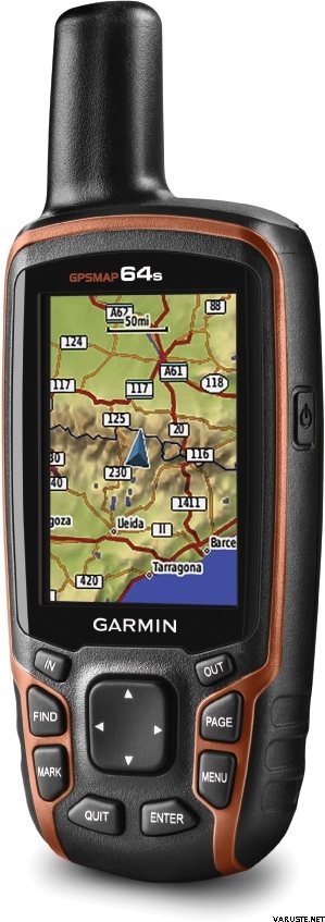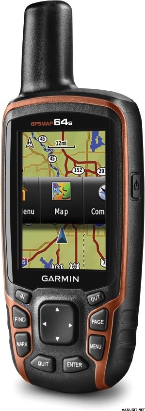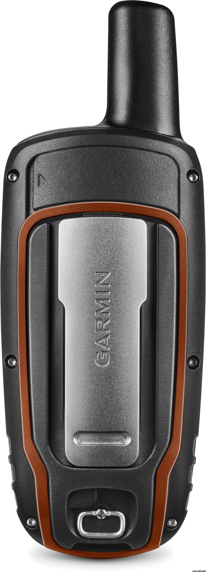
Garmin GPSMAP 64s
Dieser Artikel ist im Moment nicht verfügbar.
Verfügbarkeit auf Lager
Bewertungen
| Gesamtbewertung | (70 Bewertungen) |
Artikelbeschreibung
Rugged, Full-featured Handheld with GPS, GLONASS and Wireless Connectivity
2.6" sunlight-readable color screen
High-sensitivity GPS and GLONASS receiver with quad helix antenna
1-year BirdsEye Satellite Imagery subscription
3-axis compass with barometric altimeter
Wireless connectivity via Bluetooth® technology¹ or ANT+™
GPSMAP 64s
GPSMAP 64s features a 2.6” sunlight-readable color screen and a high-sensitivity GPS and GLONASS receiver with a quad helix antenna for superior reception. GPSMAP 64s includes a 3-axis electronic compass with barometric altimeter, wireless connectivity and a 1-year BirdsEye Satellite Imagery subscription.
Get Your Bearings
GPSMAP 64s has a built-in 3-axis tilt-compensated electronic compass, which shows your heading even when you’re standing still, without holding it level. Its barometric altimeter tracks changes in pressure to pinpoint your precise altitude, and you can even use it to plot barometric pressure over time, which can help you keep an eye on changing weather conditions.
Share Wirelessly
Share your waypoints, tracks, routes and geocaches wirelessly with other compatible devices. Your friends can enjoy your favorite hike or cache without waiting for you to plug in to your computer — simply press “send” to transfer your information to another Garmin handheld.
GPSMAP 64st also connects to compatible Garmin devices, including VIRB™ and accessory sensors, including tempe™, foot pod and heart rate monitor.
Stay Connected
With Smart Notification you can wirelessly receive email, texts and alerts from your compatible iPhone® 4s or later. Stay connected without having to dig into your backpack for your smartphone.
Explore the Terrain
GPSMAP 64s comes with a built-in worldwide basemap with shaded relief plus a 1-year BirdsEye Satellite Imagery subscription, so you can navigate anywhere with ease. With photo navigation, you can download geotagged pictures from the Internet and navigate to them.
Keep Your Fix
With its quad helix antenna and high-sensitivity, GPS and GLONASS, receiver, GPSMAP 64s locates your position quickly and precisely and maintains its location even in heavy cover and deep canyons. The advantage is clear — whether you’re in deep woods or just near tall buildings and trees, you can count on GPSMAP 64s to help you find your way when you need it the most.
Add Maps
GPSMAP 64s comes with a built-in worldwide basemap with shaded relief and a 1-year subscription of BirdsEye Satellite Imagery for a photo-realistic view. Adding more maps is easy with our array of detailed topographic, marine and road maps. With 4 GB of onboard memory and microSD™ card slot, you can conveniently download TOPO 24K and 100K maps and hit the trail, plug in BlueChart® g2 preloaded cards for a great day on the water or City Navigator NT® map data for turn-by-turn routing on roads (see maps tab for compatibility). In addition, the 64s is compatible with Garmin Custom Maps, a map format that allows you to transform paper and electronic maps easily into downloadable maps for your device, for free.
Find Fun
GPSMAP 64s supports paperless geocaching with 250,000 preloaded caches with hints and descriptions from Geocaching.com, and has a 16-hour battery life. By going paperless, you're not only helping the environment, but also improving efficiency. GPSMAP 64s stores and displays key information, including location, terrain, difficulty, hints and descriptions, which means there’s no more manually entering coordinates and paper printouts! Slim and lightweight, 64s is the perfect companion for all your outdoor pursuits.
Plan Your Next Trip
Take charge of your next adventure with BaseCamp™, software that lets you view and organize maps, waypoints, routes and tracks. This free trip-planning software even allows you to create Garmin Adventures that you can share with friends, family or fellow explorers. BaseCamp displays topographic map data in 2-D or 3-D on your computer screen, including contour lines and elevation profiles. It also can transfer an unlimited amount of satellite images to your device when paired with a BirdsEye Satellite Imagery subscription.
Dieser Artikel kann nur mit folgenden Versandarten methods geliefert werden:
- Abholung im Geschäft
- Abholung im Paketshop (DPD)
- Abholung im Paketshop (Matkahuolto)
- Abholung im Paketshop Posti
- Abholung im R-kioski oder K-Market Paketshop (DB Schenker)
- Abholung vom Paketautomat (Posti)
- Abholung vom Paketautomat (PostNord)
- Brief mit Sendungsnummer
- Europalette, während des Werktages
- Europalette, zum vereinbarten Termin
- Expressversand an die Adresse (DHL Express Worldwide)
- Lieferung an die Adresse (DB Schenker)
- Lieferung an die Adresse (Matkahuolto Jakopaketti)
- Lieferung an die Adresse (Posti)
- Lieferung an die Adresse (Posti Vormittag)
- Lieferung an die Adresse zu dem vereinbarten Zeitpunkt (Matkahuolto Kotijakelu)
- Lieferung an die Adresse zu dem vereinbarten Zeitpunkt (Posti Home Parcel)
- Posti freight to doorstep
- Rollbehälter, während des Werktages
- Rollbehälter, zum vereinbarten Termin
- Sonderpalette
Barometrischer Höhenmesser
Ja
Battery life max (h)
16
Geeignet für Geocaching
Ja
Präzision des Bildschirms
160 x 240
Satellitenkommunikation
Nein
Screen size (inches)
2,6
Gewicht
0,46 kg
(mit der Verpackung 0,8 kg)
Garantie
24 Monat(e)
Herkunftsland
Kommentare
| Gesamtbewertung | ☆☆☆☆☆ |
 — Original anzeigen
Für das erste GPS-Gerät war es schwierig, im Handbuch genau die Anweisungen zu finden, die ein Anfänger benötigt. Dem Paket fehlen Anweisungen auf Finnisch, und um sie online zu finden, sind eine Internetverbindung und die Fähigkeiten erforderlich, die weniger Beeren über 70 Jahre ohne die Hilfe jüngerer Menschen haben. Das heißt, die Gesamtstruktur benötigt einen Assistenten, um das Gerät zu verwenden.| Gesamtbewertung |
Dies war ein Geschenk an die Schwester für Rettungshundepflichten. Es ist angeblich gut gewesen. Vehje war auch an unserer gemeinsamen Hammastunturi-Wanderung beteiligt und es wurde dort festgestellt, dass es überall funktioniert. Nur einmal wurde an einer Kreuzung bemerkt, dass es sich um einen Ort handelte, der etwa 100 Meter falsch war, aber ansonsten schien es immer genau richtig auszusehen.| Gesamtbewertung |
Gutes und einfaches sicheres Gerät.
Ich habe einen Wasserstrahl als Navigationsgerät gekauft und musste weitere +150 Euro in kompatible Wasserkarten und einen Stand investieren.
Funktioniert wie es sollte und das Signal wird nicht unnötig unterbrochen. Wasserdicht.
Kann mit AA- oder NiMH-Batterien verwendet werden und hält mit einer einzigen Ladung den ganzen Tag leicht, auch wenn die Bildschirmhelligkeit voll ist.
Gutes Preis-Leistungs-Verhältnis.| Gesamtbewertung |
Praktisch genauer Gips für das Geocaching. Funktioniert bei Sommer- und Winterfrösten, da das Gerät über Tasten verfügt.
Vergebens gibt es diese vorinstallierten Tradits, die, wenn Sie ihre unnötigen Ordner löschen und GPX-Dateien sowie Geländekarten für ein so großartiges Spiel herunterladen.Marke
Siehe auch

